

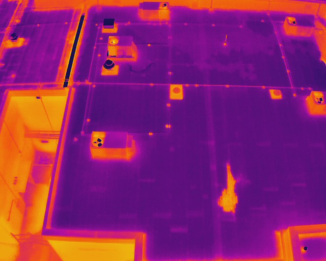
Roof Inspections
We use high-resolution cameras and infrared imaging to inspect roofs quickly and safely without ever having to step foot on the roof. From warehouses to large commercial buildings, our aerial inspections reveal hidden damage, leaks, or weak spots that aren’t visible from the ground. This fast, non-invasive approach helps catch problems early, reduce repair costs, and protect your property investment.
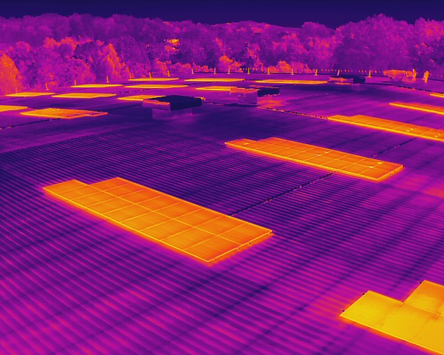
Solar Panel Inspections
We use advanced drone-mounted infrared cameras to scan solar panels and quickly identify issues that can’t be seen with the naked eye. By capturing thermal images from above, we can detect hotspots, cracks, faulty connections, and other defects that reduce efficiency. Our inspections are flexible, whether you need a small residential array checked or a large commercial solar farm surveyed, we deliver accurate results. This non-invasive method helps prevent costly downtime, improves energy output, and ensures your solar investment runs at peak performance.
Parking Lot Inspections
We use advanced aerial mapping technology to capture high-resolution images of parking lots, providing detailed views that make it easy to spot cracks, surface wear, drainage issues, and other problem areas. Our drone inspections cover everything from small lots to large complexes with speed and accuracy, helping property managers plan maintenance, improve safety, and extend the life of their pavement.

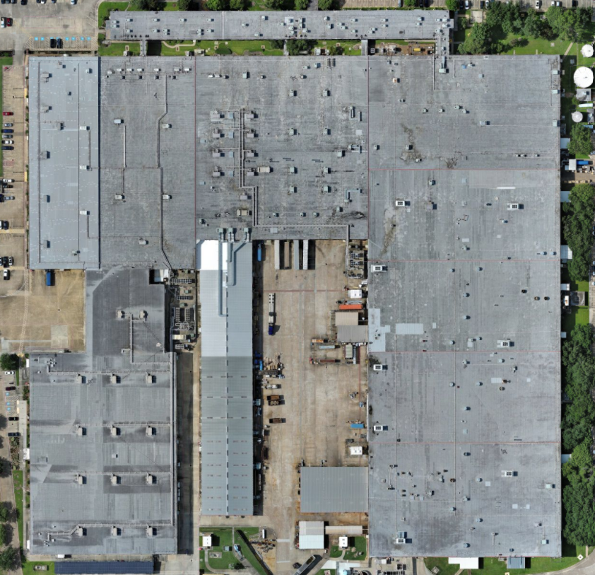
Orthomosaics
We create high-resolution, georeferenced orthomosaic maps using advanced drone imaging technology. These detailed maps provide accurate, bird’s-eye views of large areas and can be used for site planning, construction progress tracking, land management, and inspections. Orthomosaics give you precise measurements, clear documentation, and actionable insights to support smarter decision-making across projects of any size.
Aerial Imaging
Drone based aerial imaging for real estate listings, land, and commercial properties. Ideal for showing properties and their layout from above.


